Hiking Vesuvius crater: the trail, what to expect, and practical tips
Vesuvius: Entrance Ticket + Bus Round-Trip
What is the Vesuvius crater hike like and how long does it take?
A straightforward gravel path from the Quota Mille car park (1000m) to the crater rim (1281m). Elevation gain: 281 metres over roughly 600 metres horizontal distance. Time: 30–45 minutes up, 20–30 minutes down. A full rim circuit adds 45–60 minutes. Moderate difficulty — no technical skill required, but loose gravel demands solid footwear.
| Where | Parco Nazionale del Vesuvio, above Ercolano |
| Cost | €15 crater entry, plus bus transfer from Ercolano |
| Time needed | 2–2.5 hours including the rim circuit |
| Getting there | Circumvesuviana to Ercolano Scavi, then shuttle bus to Quota Mille |
| Best time | April–May or September–October, arrive before 10:00 |
The trail in detail
The Vesuvius crater hike starts at the Quota Mille (1000 metres) car park and bus terminus — named for its elevation. Everything from the car park upward is within the crater access zone and requires the €15 ticket.
The path divides into three sections:
Lower section (car park to mid-point): Wider, partly paved or compacted, with wooden railings in steeper sections. This is where the concession stands, restrooms, and guide hire point are located. The path through this section is approximately 200 metres with moderate gradient.
Upper section (mid-point to rim): The character of the path changes. The surface becomes loose volcanic lapilli (small gravel-sized volcanic fragments). The gradient steepens. This is the physically demanding section — 30–35 minutes at moderate pace. The loose surface makes each step slightly unpredictable. Trekking poles help here, especially for the descent.
Crater rim: The path reaches a designated viewpoint at the southwestern rim. From here, the signed rim trail runs clockwise (and counterclockwise, though some sections may be restricted). The full rim circuit is approximately 1.8 km and takes 45–60 minutes.
Total distances:
- Car park to rim: ~600m horizontal, 281m vertical
- Rim circuit: ~1.8km, minimal elevation change
Total time (including rim circuit): 2–2.5 hours from car park.
What to see at the crater
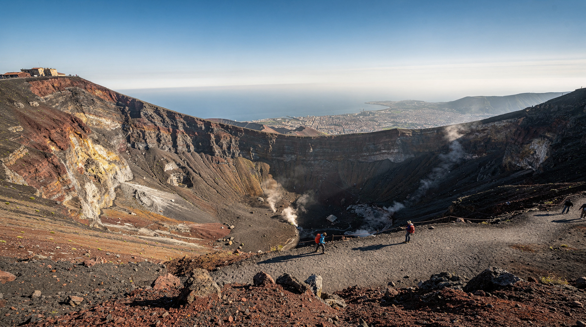
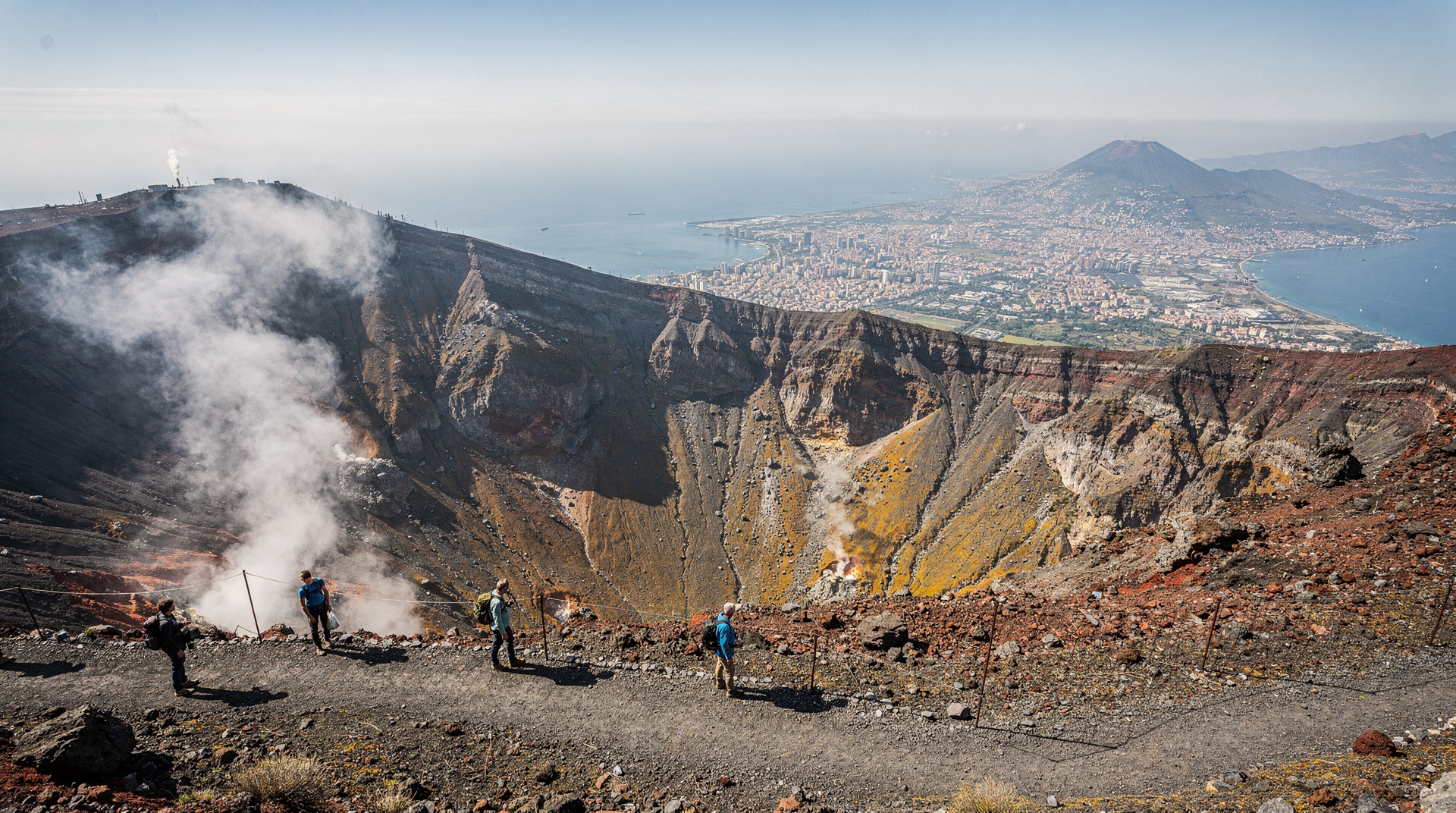
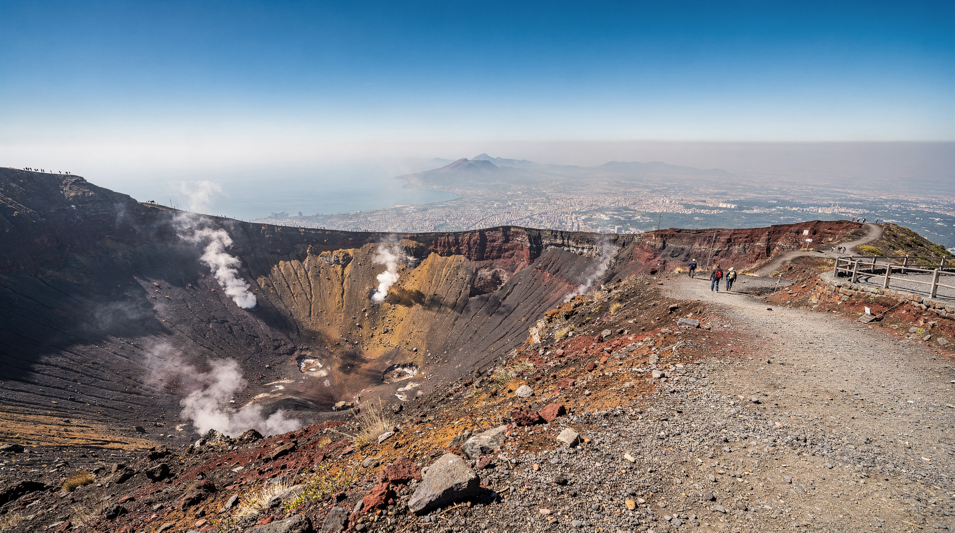
The crater itself: At 500 metres in diameter and approximately 300 metres deep, the crater is substantial. The interior walls show the geological record of eruptions — different coloured bands of lava, ash, and pyroclastic material representing different events. The base is not visible from the rim (too deep); you’re looking at the upper third of the interior.
Fumaroles: On the eastern and northeastern rim, you’ll encounter active fumaroles — vents in the rock that release hot volcanic gases (primarily water vapour and hydrogen sulphide). The sulphur smell is noticeable but not dangerous at these concentrations. In cold weather, the fumaroles produce visible plumes of steam and gas.
The Gran Cono summit: The highest point (1281m) is on the eastern rim, near the main fumarole zone. This is typically the most visited section of the rim.
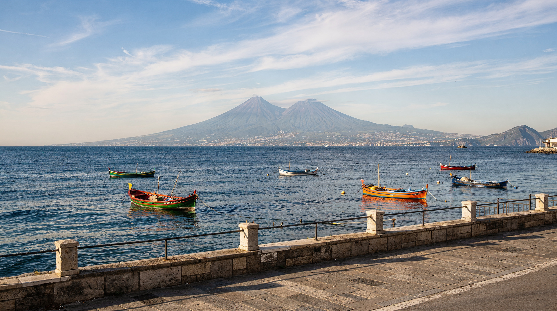
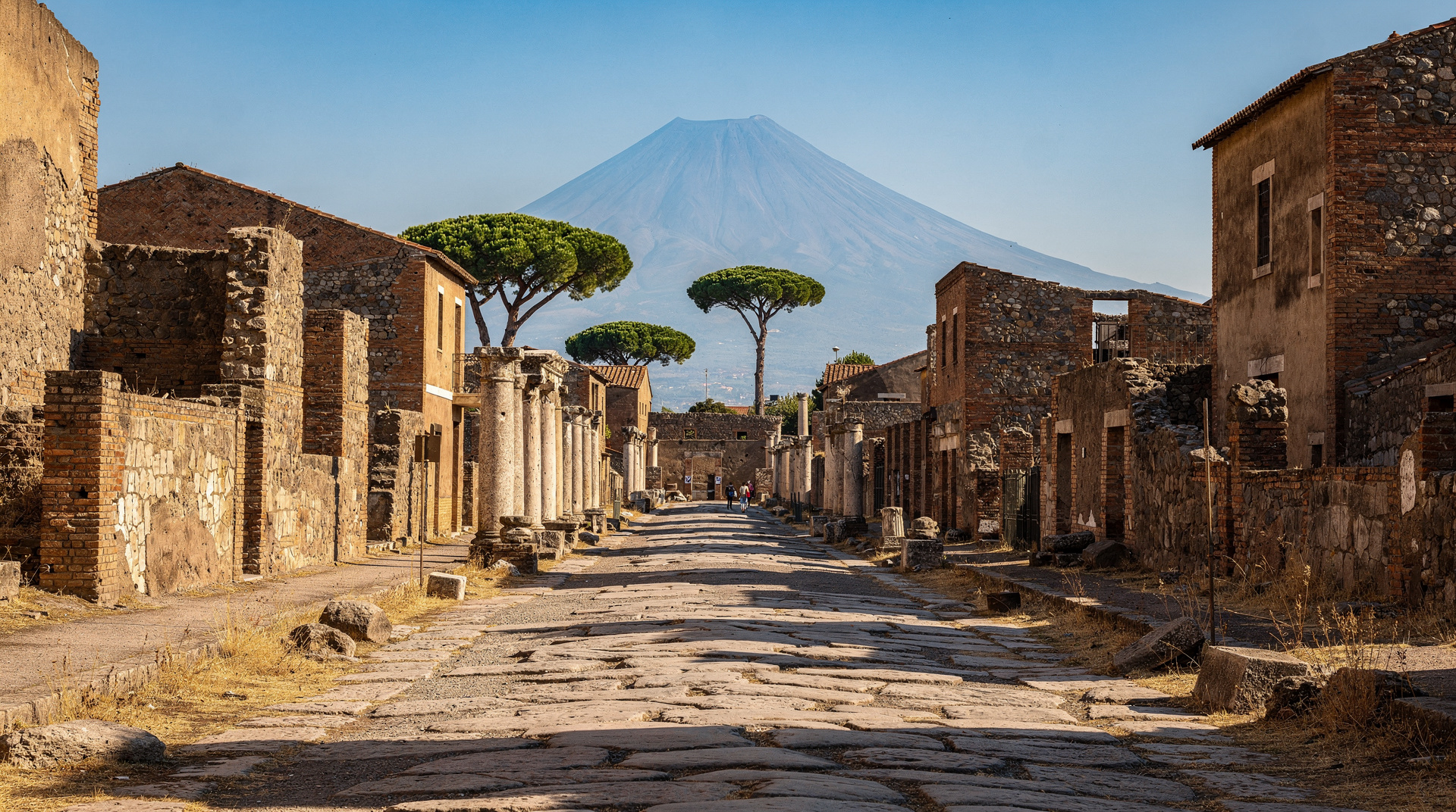
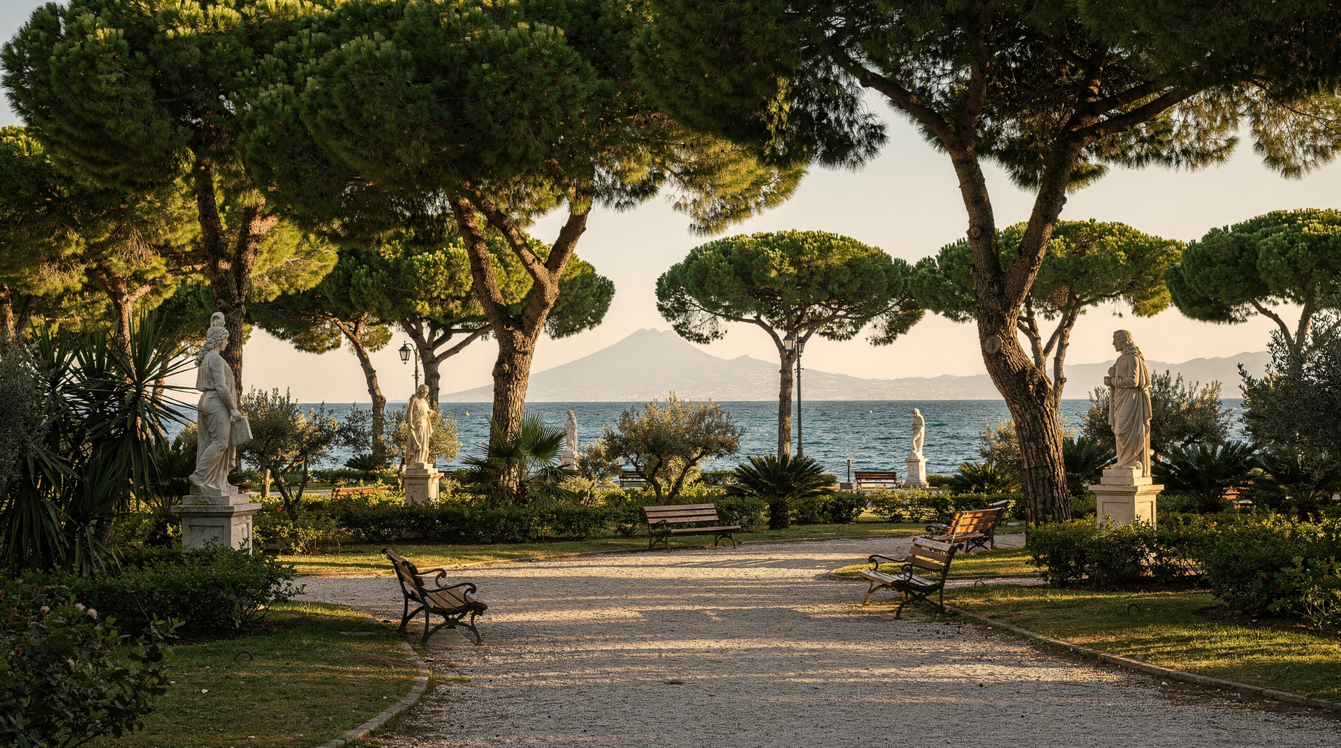
Views: To the south and southwest, the Gulf of Naples stretches to the horizon with Capri visible as a flat island. Ischia appears as a darker, higher mass. Procida is smaller, closer to the Phlegrean coast. Naples itself — the urban sprawl extending from the foot of Vesuvius to the northern shore — is spread directly below. On very clear days (rare in summer, more common in spring and autumn) you can see the Amalfi Coast and even the silhouette of Sicily.
Monte Somma: To the north, the ancient caldera wall of Monte Somma rises to 1132 metres. The Valle del Gigante (Giant’s Valley) between Somma and Gran Cono is visible from the northern rim section — a dramatic geological feature invisible from sea level.
Vesuvius crater access with digital audioguidePractical trail advice
Footwear
This is the most important single preparation decision. The loose volcanic lapilli on the upper section shifts significantly underfoot. Sandals are dangerous. Flip-flops are dangerous. Thin-soled flat shoes are difficult on the descent.
Recommended: hiking shoes or trail runners with rubber lugged soles. Ordinary trainers/sneakers with decent sole grip work adequately. The sole needs grip more than ankle support.
Clothing
Temperature at the rim is typically 5–8°C cooler than Naples sea level. In summer this means the rim might be 22–25°C when Naples is 30–33°C. Comfortable in a t-shirt on a calm day. In wind — which is frequent — this becomes 15–18°C and feels significantly colder. Bring a wind-resistant layer that packs small.
In spring and autumn, the temperature differential is larger — the rim can be 12–16°C when Naples is 20–24°C. A proper windproof jacket and light fleece are appropriate.
Water and snacks
There is a bar/café at the Quota Mille car park selling drinks, sandwiches, and ice cream (standard tourist site prices — €2–3 for water, €4–5 for a sandwich). There is nothing on the path itself. Bring water before you start.
Altitude and exertion
At 1281 metres, altitude is not a significant physiological factor for most people — this is well below the threshold where altitude sickness becomes relevant (typically above 2500m). The exertion is moderate, not strenuous. The main risk for unfit visitors is cardiovascular stress on the steeper upper section — take it at your own pace and rest if needed. Rangers can summon emergency assistance if required.
What the guided experience adds
A guided hike with a naturalist or geologist guide adds geological narrative that self-guided visitors miss:
- Eruption chronology: The coloured bands in the crater walls represent different eruptions. A guide explains which band represents 79 AD, 1631, 1872, 1906, and 1944.
- Fumarole science: What’s actually happening at the fumaroles (degassing from residual magma), why they’re concentrated on the eastern rim, and what they indicate about the volcano’s current state.
- 79 AD context: Standing at the crater rim and understanding the scale and direction of the 79 AD eruption, with Pompeii visible in the distance, is different with the eruption chronology explained from this vantage point.
The descent: the tricky part
Most visitors find the descent harder than the ascent. The loose lapilli surface causes your feet to slide forward into the toe box of your shoes on the steep upper section. Techniques:
- Slower pace than feels natural — fight the instinct to let momentum carry you.
- Shorter steps, planting each foot before committing weight.
- Trekking poles: the most effective single aid for the descent.
- Children and elderly visitors: these groups benefit most from holding a hand or using a pole on the descent.
The wooden railing sections on the lower path provide handholds. Use them.
After the hike
At the Quota Mille car park, the bar/café terrace has seating with views toward the Gulf of Naples. This is a reasonable place for a drink and a rest before continuing.
The most logical next steps from the car park:
- Bus back to Pompei Scavi (EAV bus 5001, departures approximately every hour in summer) — then Circumvesuviana to Naples or Sorrento.
- Continue to Pompeii — if you’re doing a same-day combination, start at Vesuvius and finish at Pompeii.
- Drive to Herculaneum — if you have a car, the drive to Ercolano is 20–25 minutes.
For the Pompeii + Vesuvius same-day logistics, see Pompeii and Vesuvius same day.
The rim circuit in detail
The crater rim trail runs clockwise from the main viewpoint (southwestern rim). Here’s what you encounter at different points on the circuit:
Main viewpoint (start point, southwest rim): The classic panoramic view of the Gulf of Naples opens immediately. Capri is visible to the southwest as a flat, low silhouette. Ischia appears darker and more volcanic to the northwest. The city of Naples extends in a dense urban band from the base of the mountain to the northern bay.
Southern rim (proceeding clockwise): The Sorrentine Peninsula becomes visible as you move south. Pompeii — though not distinguishable as a site from this distance — is in the flat agricultural plain below and to the southeast. The drop from the rim to the crater base is clearly visible on this section.
Eastern rim and Gran Cono summit (1281m): The highest point of Vesuvius and the main fumarole zone. Active venting is concentrated here; the sulphur smell is strongest. The rock around the active vents is discoloured yellow (sulphur deposits), orange, and rust-red (iron oxidation). These colours are genuine mineral deposits, not artistic enhancement.
Northeastern rim: The view here changes significantly — the Monte Somma caldera wall (1132m) comes into clear view to the north. The Valle del Gigante (the valley between Somma and Gran Cono) is visible below. This is the geological context that explains what Vesuvius looks like from above: not a single cone but a younger cone inside an older, collapsed volcano.
Return to start: The final section of the rim returns toward the main viewpoint, with the urban southwest view gradually returning. Total circuit: 45–60 minutes at a walking pace.
What the geology tells you
The crater walls at Vesuvius are a geological record book. Each colour band visible in the interior represents a different eruption or volcanic event:
- Dark grey/black bands: Recent lava flows (1800s–1944)
- Reddish-brown bands: Older oxidised lava
- Pale grey/white layers: Pyroclastic deposits (ash and pumice from explosive eruptions)
- Yellow deposits: Fumarolic mineral deposits (sulphur, calcium)
The 79 AD layer is not directly visible from the rim in most sections — it’s buried under nearly 2,000 years of subsequent eruptions. What you see at the rim level is primarily 17th–20th century material.
Seasonal differences on the hike
Spring (March–May): The mountain vegetation is green, the soil is more stable (less loose and dry), visibility is generally excellent, and crowds are lower. The fumaroles produce more visible steam plumes in cooler temperatures. The best conditions for the hike are April–May.
Summer (June–August): The path is at its driest and most loose-surface. Dust can be a factor on very dry days. The afternoon thunderstorm risk is real (see Vesuvius closures and weather). Views are sometimes reduced by summer haze, particularly in August.
Autumn (September–November): Transitional. September is excellent — summer haze reduces, vegetation remains green, temperatures drop to very comfortable hiking range (15–22°C at the rim). October and November see increasing closure frequency.
Winter (December–February): The hike in winter is possible on clear days but closures are frequent. Snow at the summit is rare but occurs a few times per winter. The fumaroles produce the most spectacular steam plumes in winter cold. If you visit in winter, check conditions the morning of and have a contingency plan.
Etiquette and rules on the path
Stay on the path: The volcanic slopes outside the designated trail are unstable and ecologically sensitive. Going off-path damages the fragile volcanic soil crust and is prohibited.
No collecting: Taking volcanic rock samples, pumice, or soil from the national park is prohibited. Vendors outside the gate sell legitimate specimens if you want a souvenir.
Photography: All photography is allowed on the path and rim. Drone use requires specific park permits — do not fly drones without prior authorisation.
Litter: The path has bins at the car park and on the lower section. Take all litter back down. The volcanic landscape is genuinely fragile.
Ranger instruction: Rangers patrol the path and rim. Follow their instructions without argument — they make safety calls about conditions that visitors on the path cannot assess from their vantage point.
Booking the ticket and getting there in practice
The €15 crater entry ticket is sold both online in advance and at the booth at the Quota Mille car park, but the two are not interchangeable in every season. In July and August, mid-morning slots can sell out by 10:00, particularly on weekends when both independent visitors and coach tour groups converge at the same time window. Booking a slot the day before, or the morning of, removes the risk of arriving and finding the next available entry is two hours away.
Getting to Quota Mille itself requires two legs from Naples: the Circumvesuviana train to Ercolano Scavi (about 20 minutes from Napoli Garibaldi), then a shuttle bus or minivan up the mountain (another 20–25 minutes, climbing roughly 900 metres in elevation on a winding road). Several private operators run this shuttle from just outside Ercolano Scavi station, and a combined bus-plus-crater-ticket is often simpler than buying each leg separately — see the ticket options below.
Vesuvius easy transfer with crater entry includedPacking list for the crater hike
| Item | Why it matters |
|---|---|
| Closed-toe shoes with grip | Loose lapilli makes sandals and thin soles genuinely unsafe on the descent |
| Wind-resistant layer | Rim temperature runs 5–8°C cooler than sea level, more with wind |
| 1–1.5 litres of water | Nothing sold on the path itself, only at the car park |
| Sun protection | Almost no shade on the entire route |
| Cash (€2–5) | Car park café does not always take cards |
| Trekking poles (optional) | The single most effective aid for the loose-surface descent |
Is it worth doing twice
Some visitors who come to Naples more than once ask whether the crater hike is worth repeating. The honest answer: the trail itself does not change, but the experience varies enormously with season, weather, and time of day, so a second visit under different conditions can feel genuinely new. A misty spring morning with fumaroles producing visible steam plumes is a different hike from a hazy August midday with hundreds of other visitors on the rim. If you have already done it once in peak summer, a shoulder-season repeat — ideally at opening time — is the version most likely to change your impression of the mountain.
How this compares to the rest of the Vesuvius visit
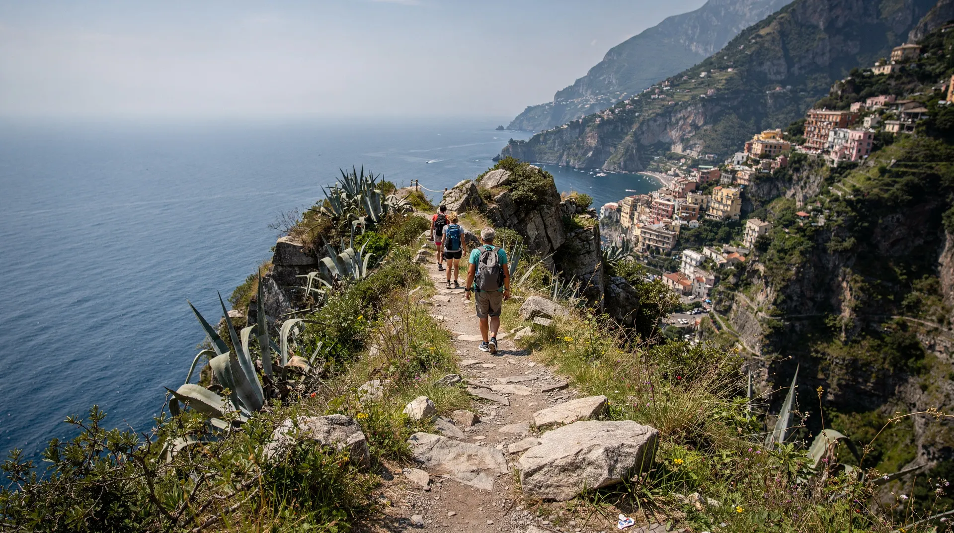
The crater hike is only one part of a Vesuvius day — most visitors combine it with the bus transfer from Ercolano, and many pair it with Pompeii or Herculaneum on the same day. If your main goal is the geological and historical context of the 79 AD eruption rather than the physical hike itself, see the Mount Vesuvius guide for the fuller picture, including the national park’s other, less-visited trails. For the wider hiking landscape around Naples — Path of the Gods, Valle delle Ferriere, and the Campi Flegrei — see hiking near Naples.
Frequently asked questions about hiking Vesuvius crater
Is the Vesuvius hike suitable for people who don’t normally hike?
Yes. The 30–45 minutes of uphill walking on loose gravel is the main physical challenge. If you can walk steadily for 45 minutes without stopping, you can complete the hike. Take breaks if needed — there is no time pressure once you have your ticket.
Are dogs allowed on the Vesuvius hike?
Dogs on leads are generally permitted in the Parco Nazionale del Vesuvio. On the crater path itself, the loose surface and crowds make it uncomfortable for dogs. Check with the park for current rules on crater access.
Can you see the bottom of the crater?
No. The crater is approximately 300 metres deep and the bottom is not visible from the rim. You’re looking at the upper interior walls and the general depth impression.
What are the fumaroles like close-up?
The active fumaroles on the eastern rim are fenced off with safety barriers — you’re typically 5–15 metres from the most active vents. At close range the sulphur smell is strong (similar to rotten eggs) and on cold days the steam is clearly visible. The rock around fumaroles is often stained yellow (sulphur deposits) and red/orange (iron oxidation). Do not attempt to get closer than the barriers allow.
Frequently asked questions about Hiking Vesuvius crater: the trail, what to expect, and practical tips
What is the path surface like on the Vesuvius hike?
Can I hike Vesuvius without paying the €15 crater fee?
How crowded is the Vesuvius hike?
Are there rangers on the Vesuvius path?
What can you see at the crater rim?
Can children hike to the Vesuvius crater?
What is the best weather for the Vesuvius hike?
Top experiences
Bookable activities with verified prices and instant confirmation on GetYourGuide.