Greco-Roman Naples: the ancient city beneath the modern one
What remains of ancient Greek and Roman Naples today?
The ancient city of Neapolis is still physically present in Naples: the Greek street grid survives in the centro storico's urban plan, the cistern network runs 40 metres underground (visible at Napoli Sotterranea), a Roman theatre sits below modern buildings on Via Anticaglia, and the National Archaeological Museum (MANN) holds the finest collection of Roman art in the world — most of it from Pompeii and Herculaneum.
The city of Naples you see today — the palaces, the churches, the street vendors, the traffic — is built directly on top of another city, and that city is built on another, and that one on another. The lowest accessible layer, the one that explains the most about why Naples is shaped the way it is, is the Greek-Roman city of Neapolis: a planned colonial settlement from the 5th century BC whose street grid is still guiding traffic 2,500 years later.
This guide traces what survives of ancient Naples: what you can see above ground, what you can visit underground, and what you need to understand about the ancient world to make sense of the modern city.
| Where | Centro storico (Spaccanapoli, Via dei Tribunali) |
| Cost | Free to walk; MANN around €15, Napoli Sotterranea around €10 |
| Time needed | 2–3 hrs self-guided walk; add 1.5–2 hrs for MANN |
| Getting there | Metro Line 1 to Dante, Museo, or Cavour |
| Best time | Morning, before the centro storico gets crowded |
The street grid: the most durable structure in European history
In the late 5th or early 4th century BC, Greek colonists from Cumae (already an established Greek city on the coast to the north) laid out Neapolis on the flat land northeast of the rocky Pizzofalcone promontory. They used standard Greek colonial planning: a rectangular grid with three main east-west roads (decumani) intersecting a series of shorter north-south streets (cardines).
The three decumani survive:
- Upper decumanus: Via dell’Anticaglia (modern Via Pisanelli) — running through the northern part of the historic centre.
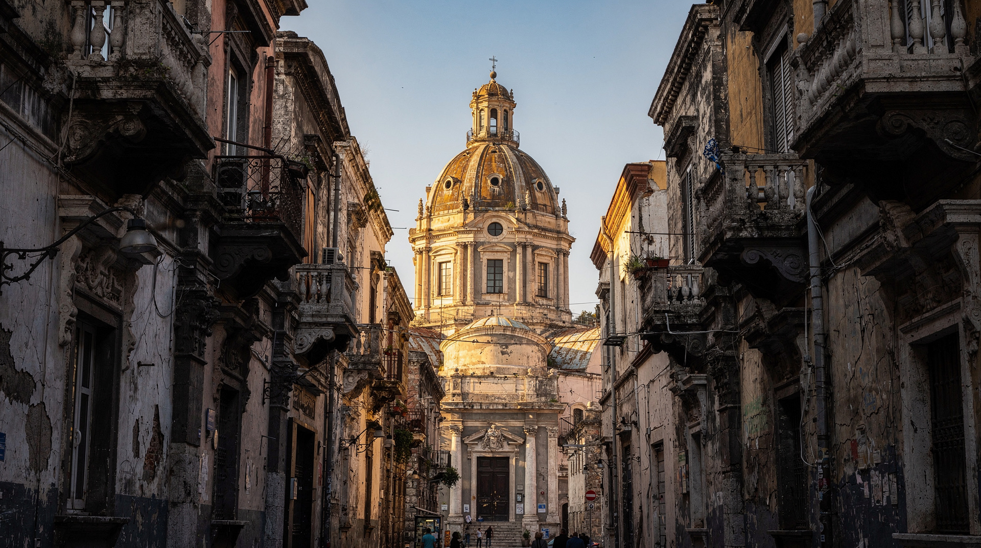
- Middle decumanus: Via dei Tribunali — the main tourist street of the centro storico, lined with churches, pizza shops, and street food vendors. This is the Greek road that Virgil and Cicero would have used.
- Lower decumanus: Via San Biagio dei Librai / Via Benedetto Croce / Via Pasquale Scura — collectively called Spaccanapoli, meaning “Split Naples” for the ruler-straight line it cuts through the city visible from the Vomero hill above.
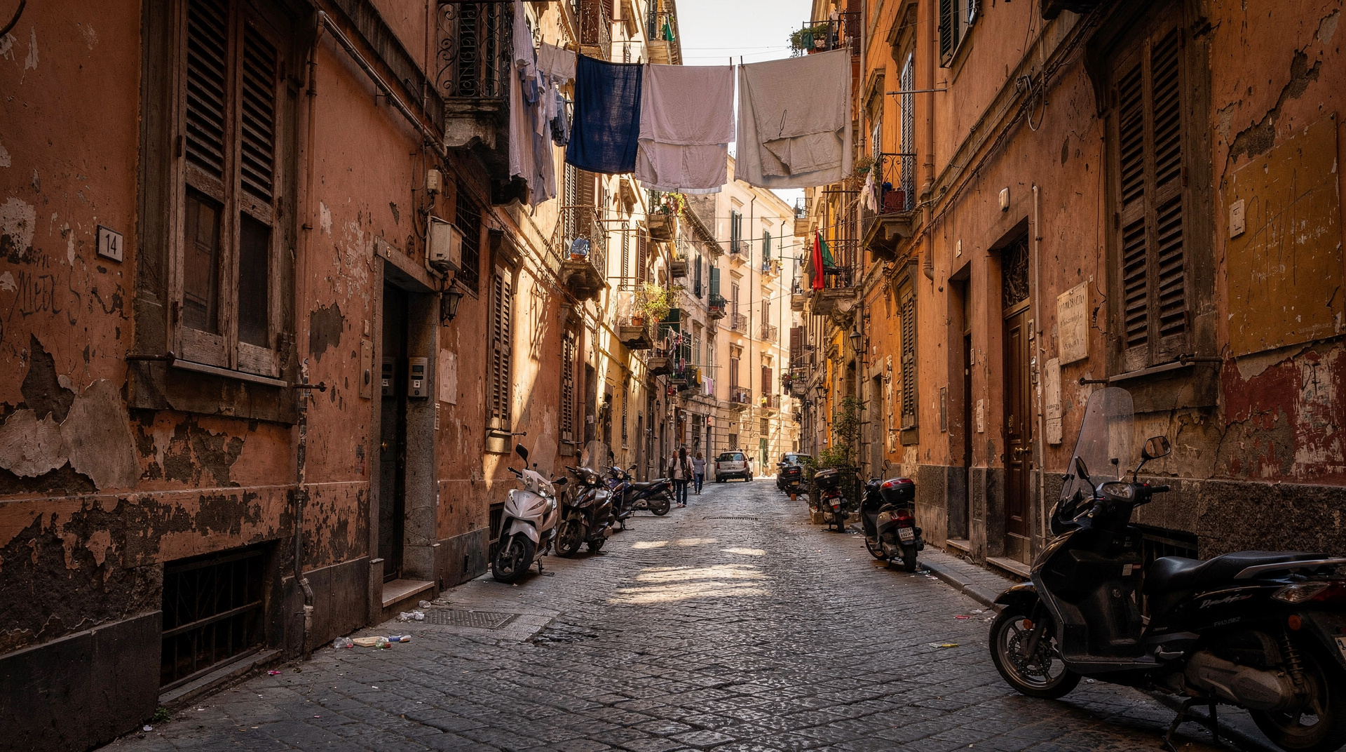
The north-south cardines are also mostly preserved — many are now the narrow vicoli (alleys) of the historic centre. The spacing between cardines (about 35–37 metres) reflects the original Greek lot size for urban property. The entire centro storico’s topology — the reason streets go where they go, why some blocks are large and others narrow, where the churches cluster and where there is open space — is a direct inheritance from the original 5th-century BC urban plan.
No other European city of comparable size has a street plan as ancient and as intact. Rome’s ancient street grid was substantially reorganised in antiquity and repeatedly thereafter. Athens’ ancient grid was largely destroyed. Naples’ grid survived because medieval and early modern builders respected (or simply couldn’t afford to replace) the property boundaries that had been fixed 2,000 years earlier.
This is worth pausing on, because it’s easy to walk through the centro storico focused on the churches and the street food and miss the grid entirely. The next time you’re standing at a corner in the historic centre, look down the cross street: if it runs arrow-straight for several blocks, you are looking at a 2,500-year-old property line, not a modern planning decision.
The cisterns: infrastructure of a major city
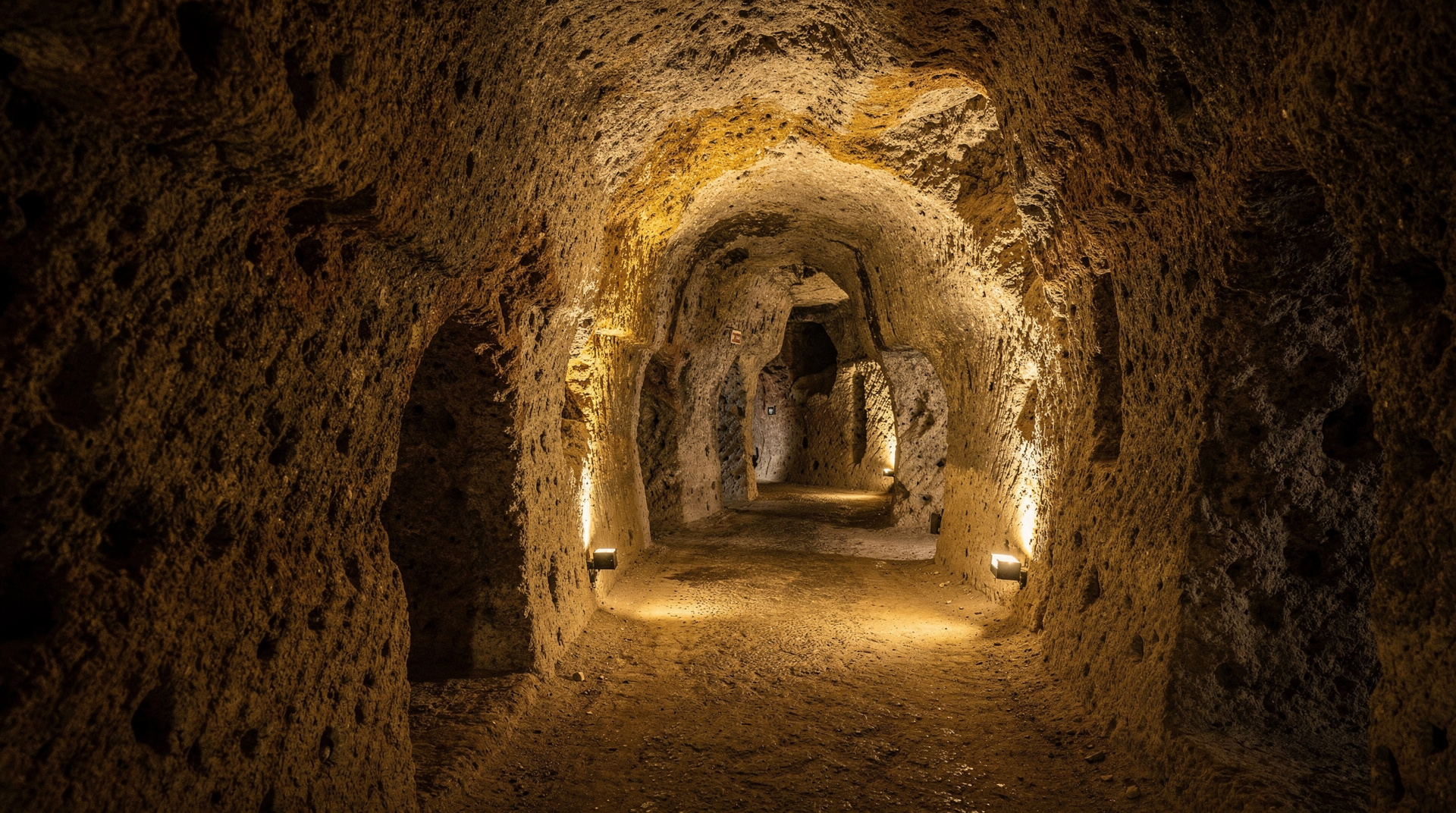
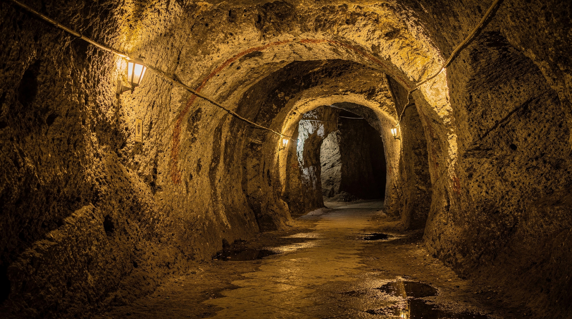
To supply water to a dense urban population, the Greek colonists cut cisterns directly into the tufa bedrock — soft volcanic stone easy to quarry and structurally reliable. The channels are typically 40–70 cm wide (the width necessary to lower a bucket) and connect to larger collection chambers. The network was expanded in Roman times as the population grew and the bath culture of Roman urban life multiplied demand.
The Roman-period cisterns connected to the Bolla aqueduct (later the Carmignano aqueduct), which brought water from springs in the hills east of the city. This system supplied Naples continuously for about 600 years — from roughly the 1st century BC to the 6th century AD, when the aqueduct was damaged during the Gothic Wars and never fully repaired.
After the aqueduct’s failure, the cisterns fell into gradual disuse and were filled over centuries with rubble thrown from above. In the 1940s, the shallower upper sections were cleared and used as WWII air-raid shelters.
The most accessible section of this ancient infrastructure is the Napoli Sotterranea tour, which descends 40 metres below Piazza San Gaetano into a connected series of cistern channels. The tool marks from the original Greek workers are still visible in the tufa walls. The scale of the Roman-period expansion — the widened channels, the distribution chambers, the sheer extent of the network — communicates the size and sophistication of the city that sat above.
The Roman theatre under Via Anticaglia
On Via dell’Anticaglia — the northern decumanus — two large arched structures span the street at rooftop height. These are the remains of the vaulted substructure of the Roman theatre of Neapolis: a large theatre that could seat approximately 6,000 people, built in the 1st century AD in the Roman imperial period.
The theatre is substantially preserved underground; the above-ground remnants (the arches) give only a hint of the original scale. The emperor Nero is documented as having performed here — ancient sources record his theatrical performances in Naples as both embarrassing and popular, Nero having a genuine enthusiasm for performing that Roman aristocratic conventions found undignified.
The theatre was never fully excavated. The medieval and early modern buildings that grew on top of it incorporated its vaulted substructures as foundations. Some sections are accessible through private properties and through the lower levels of the Napoli Sotterranea underground circuit; there is no publicly accessible excavated site at ground level.
This partial visibility is typical of how ancient Naples reveals itself generally — rarely as a complete, roped-off site, more often as a fragment glimpsed through a modern doorway, a cellar, or a gap between buildings. Part of the appeal for visitors who enjoy this kind of history is the detective work of noticing these fragments rather than being handed a fully excavated monument.
Temples and sacred sites
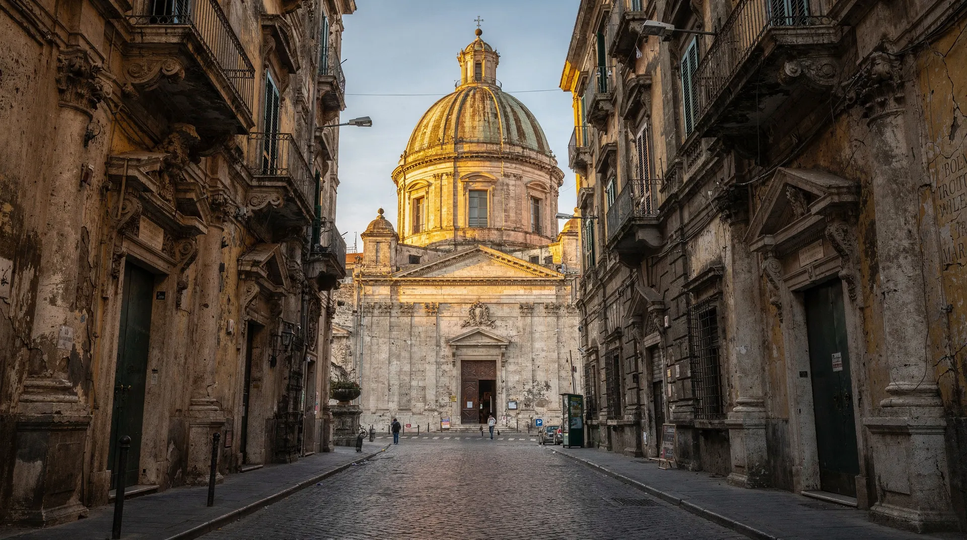
Naples’ Greek religious infrastructure is almost entirely invisible today — it was replaced by medieval churches built on the same holy sites, following the standard Christian practice of consecrating existing sacred locations. Two tangible traces survive.
San Paolo Maggiore, Piazza San Gaetano. The 16th-century church of San Paolo Maggiore was built on the site of a Roman temple — the Temple of the Dioscuri (Castor and Pollux), the twin divine patrons of sailors. Two Corinthian columns from this temple survive, incorporated into the church façade at the building’s corners. They are the most visible surviving elements of classical religious architecture in the centro storico — massive, slightly incongruous, and precisely placed where the Roman temple colonnade once stood.
The Serapeum at Pozzuoli. Strictly speaking outside Naples, but essential to understanding the broader ancient urban landscape: the macellum (market building) at Pozzuoli — long misidentified as a Temple of Serapis due to a statue found there — is one of the best-preserved Roman commercial buildings in Italy. The columns show tide marks and marine boring at various heights, evidence that this part of the coastline has risen and fallen relative to sea level (bradyseism — a process driven by the volcanic activity of the Campi Flegrei) by several metres over the past two thousand years.
The MANN: the world’s best Roman collection
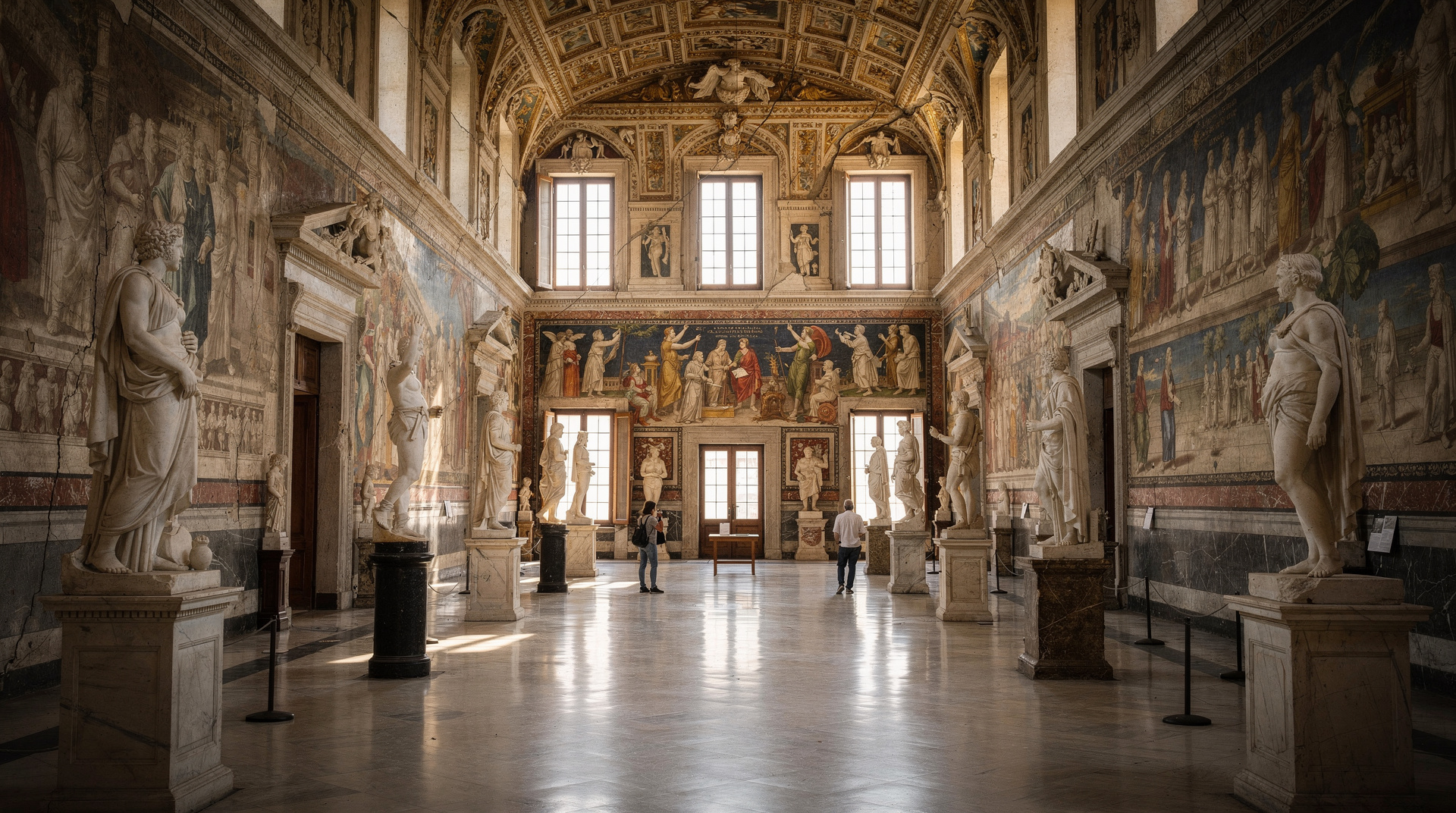
The National Archaeological Museum of Naples (MANN) on Piazza Cavour is where the story of Greco-Roman Naples is most completely told. Two separate collections make it essential:
The Farnese collection. The Farnese family had been collecting classical sculpture for generations when their property passed to the Bourbons in the 18th century. The collection includes the Farnese Hercules (a 3rd-century AD Roman copy of a Greek original by Lysippos, found in the Baths of Caracalla in Rome) and the Farnese Bull (the largest single sculpture excavated from antiquity, a 2nd-century AD copy of a Hellenistic original). These pieces alone justify the museum.
The Pompeii and Herculaneum material. Everything extracted from the excavations of Pompeii and Herculaneum that was not left in situ is at MANN. This includes: the Alexander Mosaic (a 1st-century BC Roman copy in tesserae of a 4th-century BC Greek painting, depicting Alexander the Great’s victory over Darius III at Issus); intact fresco cycles from villa walls; the Secret Cabinet (Gabinetto Segreto) of erotic art; reconstructed garden paintings; mosaics of extraordinary technical quality; surgical instruments; jewellery; household furniture; and the physical objects of daily Roman life at a quality and quantity no other museum can match.
Visiting MANN before going to Pompeii makes the Pompeii experience significantly richer — you have a visual vocabulary for what the houses looked like decorated, what the objects found in them were used for, and what the artistic aspirations of the inhabitants were.
MANN National Archaeological Museum guided tourFor visitors who prefer a self-paced visit, a digital audio guide covers the same highlights without needing to keep pace with a group.
MANN digital audio guideWalking the ancient city today
The experience of ancient Naples is mostly a palimpsest exercise — identifying what is old underneath what is new. A self-guided walk along the three decumani reveals this layering in real time:
Starting point: Piazza San Gaetano. This was the heart of ancient Neapolis — the agora (Greek) or forum (Roman), the civic centre. The church of San Paolo Maggiore occupies the Roman temple site. The entrance to Napoli Sotterranea is in a courtyard off the same piazza. Standing here, you are at the intersection of the middle and upper decumani, at the geographic centre of the 2,500-year-old city.
Walk east along Via dei Tribunali. The street width and alignment are Greek. The medieval towers, Baroque church facades, pizza ovens, and phone repair shops are not. Count the church campaniles above roofline level — most mark the sites of Roman or early medieval sacred buildings.
Via dell’Anticaglia. The two arches spanning the street are Roman theatre vaulting. The height above street level shows how much the ground has risen over 2,000 years of accumulation.
Walk west along Spaccanapoli. The ruler-straight alignment of the lower decumanus is most clearly appreciated from the Vomero hill above, where the urban geography makes it visible. On the ground, the same straightness that the Greeks planned — visible in the fact that you can stand at one end of Spaccanapoli and see the street continuing to the horizon — is experienced as a spatial quality that no subsequent city planning has managed to alter.
For a more structured walk, the self-guided walking tour of Naples includes the main Greco-Roman stopping points.
The wider ancient landscape: Campi Flegrei
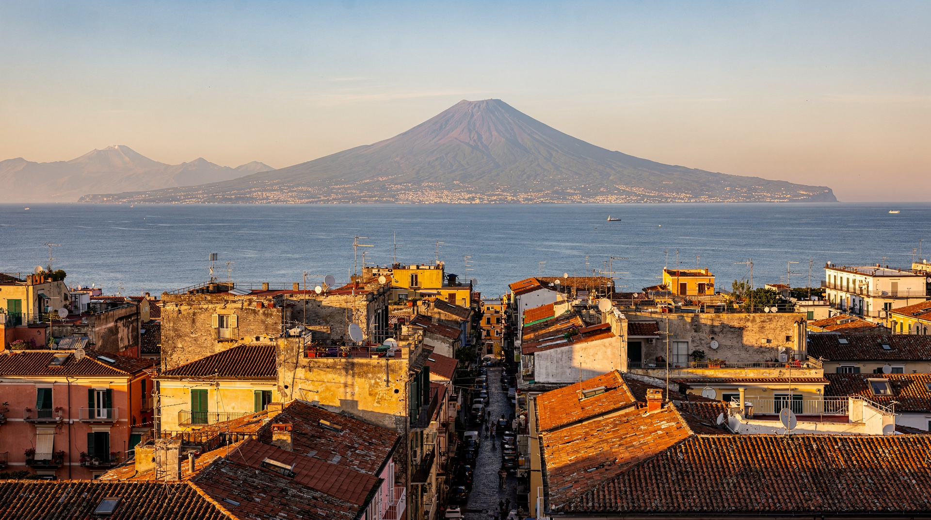
The Campi Flegrei volcanic field that underlies the Naples area produced not only the tufa that built the city but also the landscape that made the bay attractive to Greek colonists in the first place. The Greek cities of Cumae, Dicaearchia (later Puteoli, now Pozzuoli), and Parthenope were all established on elevated promontories and volcanic capes that offered defensive advantages and access to the sea.
A Campi Flegrei day trip from Naples can include Cumae (the oldest Greek colony in the area, with the cave of the Cumaean Sibyl), Pozzuoli’s Roman amphitheatre (better preserved than the Colosseum in some respects), and the coastal landscape that was the most desirable real estate in the Roman world. The volcanic activity of the region — bradyseism (slow ground movement), thermal springs, sulphur emissions — that attracted Roman spa culture is still ongoing.
For visitors piecing together the whole ancient landscape of the bay, the Campi Flegrei sites are best understood as an extension of the Neapolis story rather than a separate excursion: Cumae is where the colonists who founded Naples originated, and the volcanic geology that shaped Pozzuoli’s ancient economy is the same geology underlying the tufa quarried for Naples’ own cisterns and theatre. A day spent at Campi Flegrei genuinely deepens what you saw walking the decumani in the city itself, particularly if you visit MANN first — several objects on display there come directly from Cumae and Pozzuoli excavations.
Frequently asked questions about Greco-Roman Naples
Why is the ancient city so hard to see above ground?
Naples has been continuously inhabited — at high density — for 2,500 years. Each generation built on top of the previous one, repurposed existing structures, and used ancient materials for new construction. Unlike Pompeii, which was sealed by volcanic material at a single moment, Naples accumulated layer after layer of human activity that buried, incorporated, and obscured the ancient city. What survives above ground tends to be only what was too large or too structurally useful to demolish.
Is there anywhere in Naples where I can see Roman-period street level?
At Napoli Sotterranea, you walk through spaces at the level of the ancient cisterns, but these were below ground in Roman times. The Roman-period street surface itself — approximately 4–6 metres below the current street in most of the centro storico — is not publicly accessible. It has been reached in excavations but not opened to visitors.
How does Naples’ ancient heritage compare to Rome’s?
Rome has more visible above-ground ancient monuments. Naples has better-preserved material from the Roman world’s everyday life — primarily through the Pompeii and Herculaneum collections at MANN. The two cities are complementary: Rome shows you the monumental public face of Roman civilisation; Naples shows you how Roman people actually lived.
Were Naples and Pompeii part of the same ancient city?
No. Pompeii was a separate, independent city — Oscan-speaking before Roman colonisation, located approximately 24 km southeast of Naples at the mouth of the Sarno river. Pompeii became a Roman colony in 80 BC. Naples and Pompeii were distinct urban centres with different populations, different political statuses, and different functions within the regional economy.
Planning a Greco-Roman day in Naples
For visitors with a genuine interest in the ancient city, a realistic sequence is: morning at MANN (2 hours, to build the visual vocabulary), then the self-guided decumani walk through the centro storico (2–3 hours including lunch), finishing with a Napoli Sotterranea tour in the late afternoon when the underground network is often less crowded than the mid-morning slots.
This order lets the museum objects inform what you’re looking at above ground, rather than the reverse. See the self-guided walking tour of Naples for a turn-by-turn version of the decumani route, and the Naples history guide for how the Greco-Roman period fits into the fuller 2,500-year story of the city.
Comparing Naples’ ancient layer to the sites you’ll see later
If your trip continues to Pompeii or Herculaneum, it helps to know what you’re comparing. Naples shows the ancient city as a living palimpsest — a street grid still carrying traffic, temples reused as churches, theatre vaults holding up modern buildings. Pompeii and Herculaneum show the opposite: cities frozen at a single moment by the AD 79 eruption, with none of the intervening centuries of reuse. Seeing Naples’ Greco-Roman traces first, then Pompeii’s suspended-in-time streets, gives a genuinely fuller picture of Roman urban life than either site alone.